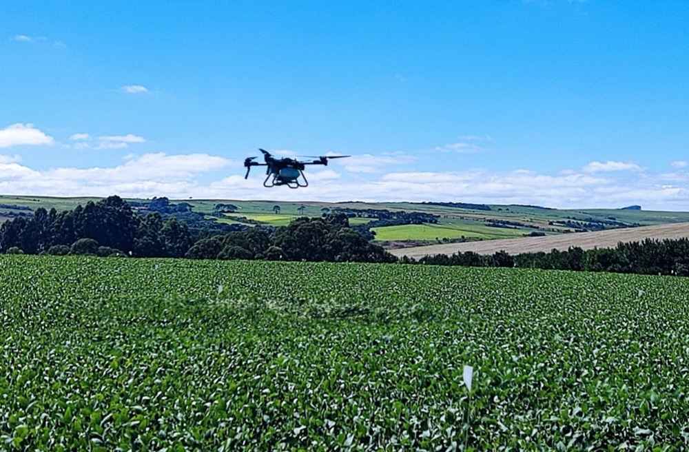
UK-based ProCam has launched a new precision farming service that will take effect in autumn 2025.
FieldSense uses satellite mapping of soil and crop variability across fields; this is then used to derive variable rate input applications tailored to these variations with the aim of improving economic crop output across the field and bringing environmental gains.
ProCam says FieldSense is easily accessed via a web browser, and is based on a collaborative approach between the agronomist and grower.
According to ProCam regional technical manager Nigel Scott, it will be the ProCam agronomist who makes sense of the satellite images, “drawing on their boots-on-the-ground experience of the field and ground-truthing any anomalies that the images might reveal.
“This can be combined with the farmer’s own knowledge of the field as necessary,” explains Scott. “Once maps have been interpreted, the agronomist will produce variable rate files for downloading directly to the tractor that is controlling the drill or fertilizer applicator. Growers can also cherry pick only those parts of the package relevant to their farm and machinery, and can begin by trying FieldSense over just a few hectares.”
ProCam western region technical manager, Harry James, says this first phase launch will focus on four key areas for combinable cropping: grid-based soil sampling; variable rate seeding; variable rate nitrogen (N), phosphate (P), potash (K) and lime applications; and yield mapping input.
The process starts by mapping fields into various sized grids – for example, one hectare squares for soil sampling, 24 metres squared grids for variable rate fertilizer spreading, and six metres squared grids for variable rate drilling, or the most appropriate grid size for the width of machine.
“The variable rate drilling package in FieldSense uses historical NDVI satellite maps that are available that show the variations in crop biomass that have occurred in that field over multiple years,” James explains. “From these, the agronomist will create a variable seed rate plan – to drill proportionally more seed in historically lower biomass grid squares and less seed where less is needed – with the aim of achieving a uniform, optimum tiller density over the whole field.”
For soil sampling, Scott says the location of where samples were taken from in each hectare is captured by GPS and shared back to the FieldSense platform. Samples can be analyzed using ProCam’s SoilSense service, he says, with the resulting gridded nutrient maps produced used by the agronomist to create variable rate spreading files to correct P and K deficiencies, and for liming if required.
“Variable rate N application, on the other hand, uses satellite NDVI measurements of the growing crop,” Scott says. “These are taken every five to seven days on a 10m x 10m grid or every three to five days on a 3m x 3m grid. Here, the aim is to use variable rate N to produce the optimum green area index (GAI) over the whole field. Farm-testing in oilseed rape where GAI in March was found to vary from a near optimum of 3.0 to just 1.0, showed that by varying N dose between 60 to 90 kg/ha, crop uniformity was corrected by early June.
“In fields where yield mapping is carried out on the combine harvester, yield data can also be uploaded into FieldSense to guide future agronomic decisions,” he added.
The launch of FieldSense is the latest in a sequence of technical introductions from ProCam, following on from the launch of the soil testing and nutrient planning service, SoilSense, last year.